GRASP Open Code
The code is open for all users with scientific purposes. Let’s start using GRASP algorithm by your own!
POLDER-1-2 and POLDER-3/PARASOL
GRASP algorithm has been applied to the entire archive of the French Space Agency’s POLDER-3/PARASOL (~ 9 years) and POLDER-1 and -2 (~ 1,5 years) instruments, obtaining a wide variety of aerosol and surface characteristics, including Aerosol Optical Depth of extinction (AOD) and absorption (AAOD), Single Scattering Albedo (SSA), Angstrom Exponent (AE), Surface Albedo, NDVI vegetation index, etc.
The video on the right shows a moving average of obtained AOD at 565nm (the data from first PARASOL/GRASP «optimized» processing were used).
To read more and to download the latest data post-processed by GRASP SAS please proceed with the ‘download’ button below.
MERIS/ENVISAT
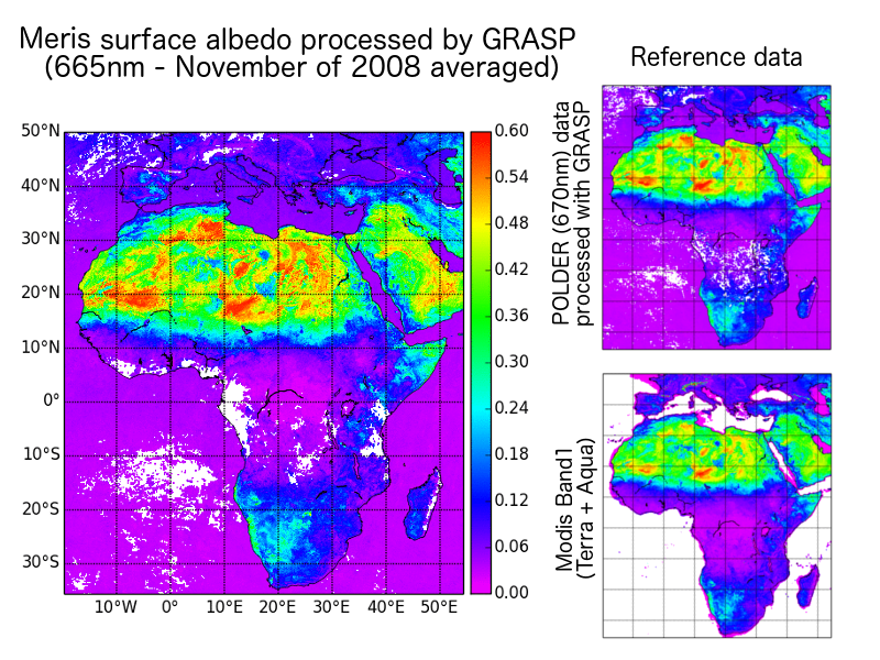
Within the framework of projects supported by ESA, GRASP algorithm has been optimized and applied to the data of MERIS instrument. Two important results have been obtained from those studies:
- The information about surface and aerosols (aerosol optical depth, single-scattering albedo, etc.) for the entire MERIS mission has been obtained. Full archive is available for free at this website. Click the button below to download the data.
- A reimplementation of GRASP forward model using GPGPU technologies has been developed successfully, allowing the code to run parallelized over graphic cards and obtaining faster results (up to 100x). This developments work as external and optional module for GRASP. It is going to be released as an open source and can be selected at compilation time.
ENVISAT
CAWA-2 project intends to use the heritage of the CAWA project as well as the recent advancements realized within the GRASP-Open software package to establish and extend the concept for generating synergy MERIS+AATSR products.
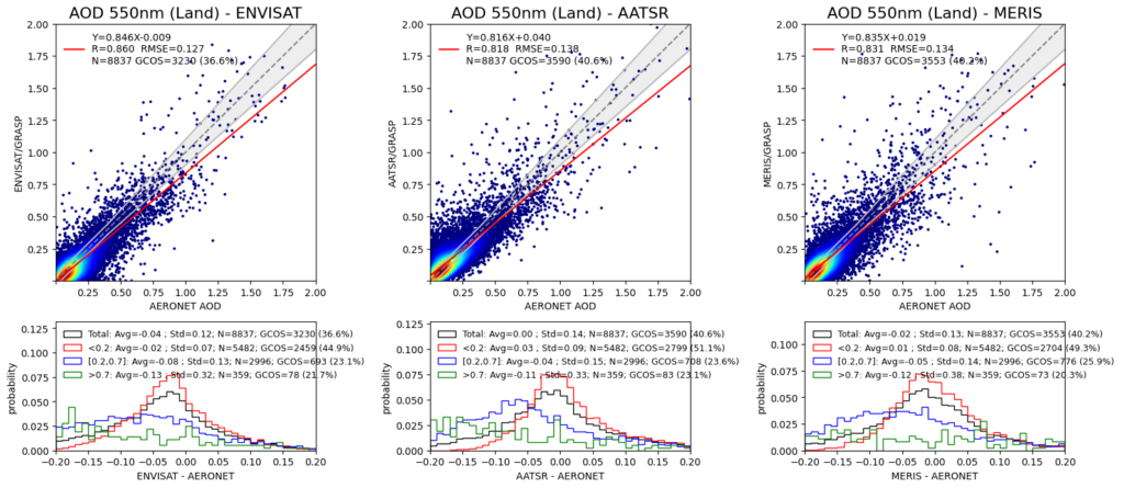
Thus, the scope of this project is to fully develop a synergy MERIS+AATSR retrieval scheme, to test it, and to eventually apply it to the full archive of MERIS and AATSR data. This GRASP/MERIS+AATSR data set is then to be validated against AERONET as reference and intercompared with other satellite-derived data sets, including existing MERIS+AATSR synergy data where available.
In addition, an optional activity of this project is to update the MERIS/GRASP and to extend the AATSR/GRASP retrieval schemes and to process the full archives of MERIS and AATSR individually to generate an updated MERIS/GRASP dataset and a new AATSR/GRASP data set. These data sets are expected to be analyzed individually and compared to the synergy MERIS+AATSR data with the purpose of improving the understanding of the information content of each instrument and the value added of MERIS+AATSR synergy processing. These individual products will serve the community when they want to use a single-instrument data set, e.g. for intercomparison exercises.
Download ENVISAT data
TROPOMI/Sentinel-5p
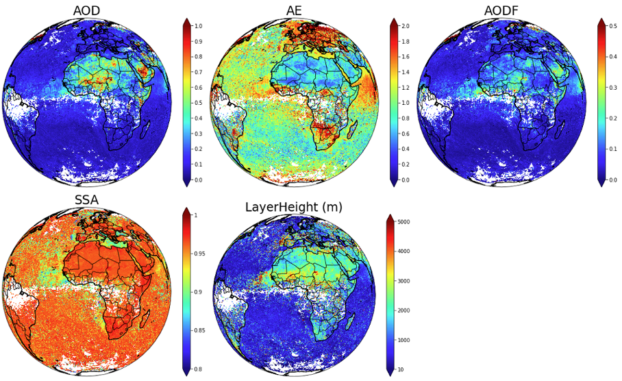
In the framework of ESA S5p+Innovation AOD/BRDF project, the GRASP algorithm is adapted to the development of a product of spectral surface BRDF and aerosol information from (and for) the TROPOMI instrument. S5p/TROPOMI GRASP aerosol and surface products contain direct retrieved aerosol and surface parameters as well as derived aerosol optical properties (spectral AOD, AODF, AODC, SSA etc.) and surface NDVI, spectral DHR (black sky albedo) and spectral BHR_iso (white sky albedo). Both aerosol and surface products are derived at spatial resolution of about 10 km and at UV-VIS-NIR-SWIR 10 wavelengths. Click the button below to get more details and download the data.
OLCI/Sentinel-3A
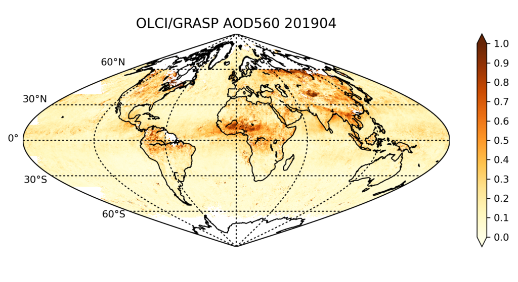
In the framework of EUMETSAT funded projects to support Copernicus Programme, the GRASP algorithm has been adapted and applied to the inversion of Sentinel-3A/OLCI measurements. One year (June 2018 to May 2019) V1.0 aerosol and surface products are derived from the OLCI measurements. OLCI/GRASP retrieval generates both aerosol and surface products simultaneously in the fully consistent manner globally and the products show comparable quality to the community-reference MODIS. Click the button below to download the data.
GROSAT Synergetic approach
In the framework of ESA “Synergetic retrieval from Ground-based and Satellites measurements: new possibilities for surface characterization and validation” (GROSAT) project (https://www.grasp-sas.com/projects/grosat/), a simultaneous synergistic retrieval of aerosol and surface properties approach (GRASP/GROSAT approach) is developed using combined ground-based AERONET and satellite measurements. In such retrieval the main information about aerosol comes from AERONET direct sun and diffuse sky-radiance measurements, whereas the information about surface reflection properties originates from satellite observations. Such approach allows obtaining the surface reflectance product with enhanced accuracy.
Download GROSAT data
Spheroid-package
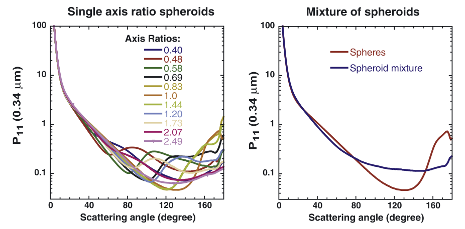
Spheroid package allows fast, fairly accurate, and flexible modelling of single scattering properties by polydisperse randomly oriented spheroids with different size and shape distributions. It includes a software and kernels data base. The details of the scientific concept are described in the paper by Dubovik et al. (2006). The software tool is also, at present, used in GRASP inversion algorithm for retrieving detailed aerosol properties from laboratory or remote sensing polarimetric measurements of light scattering.
Download Spheroid-package
Lidar + Sun/Sky Radiometer
Grasp algorithm provides the possibility state-of-the-art synergetic retrievals inverting simultaneously sun/sky radiometer and lidar ground-based observations. Specifically, the following of these synergetic retrievals can be outlined:
- Inverting simultaneously radiometer and lidar measurements, GRASP allows to provide the detailed retrieval of columnar–integrated properties (particles’ size distribution, complex refractive index, sphericity fraction, AOD and absorption) together with the information about aerosol vertical distribution.
- Synergy of radiometer and lidar data allows the retrieval to distinguish between fine and coarse mode and to provide information that is not available when using only radiometer or lidar data, for example characterization of vertical distribution of aerosol absorption or single scattering albedo.
- GRASP can process observations even from rather complex lidar systems measure non-elastic Raman and polarized scattering of atmospheric layers. Using synergy of observations by such lidar and sun-photometers significantly enhances the retrieval accuracy.
- GRASP retrieval can utilize multi-temporal a priori constraints on variability of aerosol properties that allow for realizing synergy retrieval even for the not fully co-incident and/or simultaneous observations.
